|
Eminences in Progress |
| 2020-12-14 |
Eminences in Progress
Our campaign is taking place in Dark Ages England. I can fire up Google Maps and have a look at the locations and imagine what they were twelve centuries ago. The woods were perhaps larger, lowlands may have been swamps, that place name hints at what used to be here...
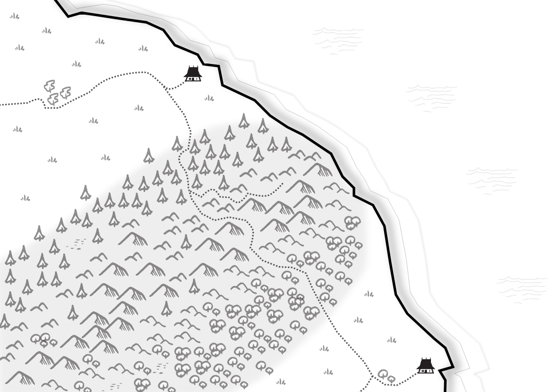
One tentative scenario was supposed to take place by the sea. I had come up with a plain intersected by a mountain range (see that map, icons from John Grumph's De Chorographia). At that point I was planning on playing in northwestern England but not telling the players, but when the campaign started, for easier immersion, I told the players "we are playing in what is to become England, around Anno Domini 890".
Our first sessions featured wooded hills and a cramped tunnel across a hill. I had come up with that, but would that fit our topography? Was there a way for me to have maps telling me about the lay of the land? With the kind of details I cared for?
I am working on a tool that generates maps for me. Like many gamers, I am attracted to hexes (by the way, have a look at Axel Schroeder's hex-describe, scroll down, hit submit then wait a little bit...).
It is not that I want my players to go hexcrawling, the maps I want will help me prepare sessions.
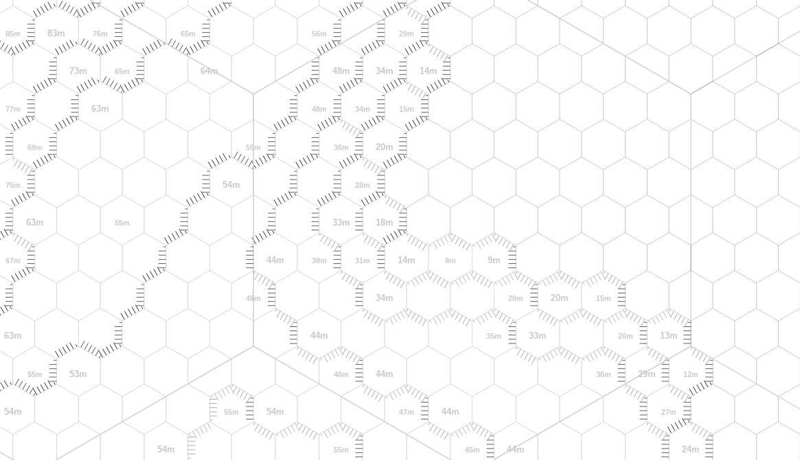
The tool I am building accepts a starting corner latitude and longitude and then fetches online the elevation for a set of 100m diameter hexes. The image above shows the current iteration's output. The faded number inside an hex is its elevation in meter, blank blueish hexes are sea hexes.
I am currently experimenting with hachures to denote elevation deltas between hexes and it looks promising. I'll probably next try to make the northwestern light exposed hachures a bit lighter.
Elevations are easy to fetch online, but I'd like to fetch current rivers, woods, churches, and place names as well, to at least inform the placing of features on my final maps. Currently playing with Overpass.
Since it's Dark Ages England, I'll probably limit the maps visible to player characters to schema drawn in the sand, road goes to ford, continues to hill and hamlet, done. Still I might print snippets of my hexmaps and show them to the players: "This is the surroundings of the village, see the low and high points, the way the land slopes to the sea, the road after the village goes south and enters a wood..."


