|
Eminences in Green |
| 2020-12-20 |
Eminences in Green

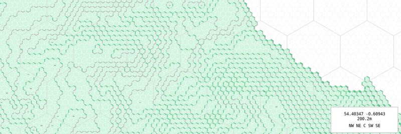
I am writing this tool named Archelaus to draw hexmaps with elevation. It's work in progress. I am experimenting with ways to render the contour, the screenshot above shows at what stage I am as I am typing those lines.
Ten kilometers by ten seem to be a good spot not to clog the browser with all the svg to render. I've added navigation by dragging and zooming by scrolling. Keyboard navigation has been added as well (pan with arrow keys, zoom with pgup and pgdown).
Click on the image above to try and navigate around. Please note that it's not yet mobile browser friendly.
For the contour I tried to show four different level of slope by the height of their hachure. I have also tried to make northwest oriented slopes "sunnier". Zoomed out it looks nice, zoomed in, it's less satisfactory.
I have found ways to fetch data from OpenStreetMap and I will work on showing rivers and streams on the maps. I will also try ot show forests and woods, but it looks trickier, and then there is the added question mark, dark age England land cover vs current England land cover.
My hope is that this tool and the maps it will generate will help me in my scenario preparations.


