|
Hard Map |
| 2022-08-23 |
Hard Map
I am preparing a one shot, I have a vague idea. I decided to prepare a map for the players. Well, it's more a model than a map.
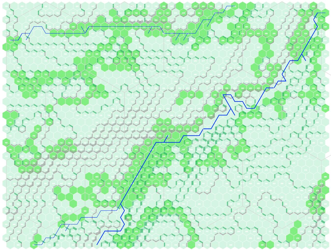
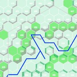
My tool fetches OpenStreetMap data, mostly elevation, forests, and rivers, and generates a web map. I am use a place in the middle of Europe which has the sun orientation that I wanted.
There are many fine tools out there to randomly generate places, but the world is vast, why not simply pick a place whose contours are shaped by real tectonic plates, rivers, and glacier planes?
I had tested my tool against Lindisfarne, islands are easier to grasp than maps of places without a large area of water.
Maps are fine for referees. Sometimes, we want the players and their characters to have some insight into the place where the action takes place. I tell the players that each hex fits a soccer field. There is 100m from the center of a hex to the center of the next. Ten hexes and you have a kilometer.
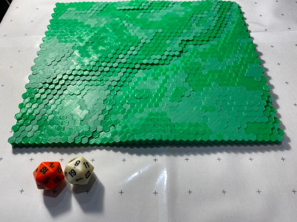
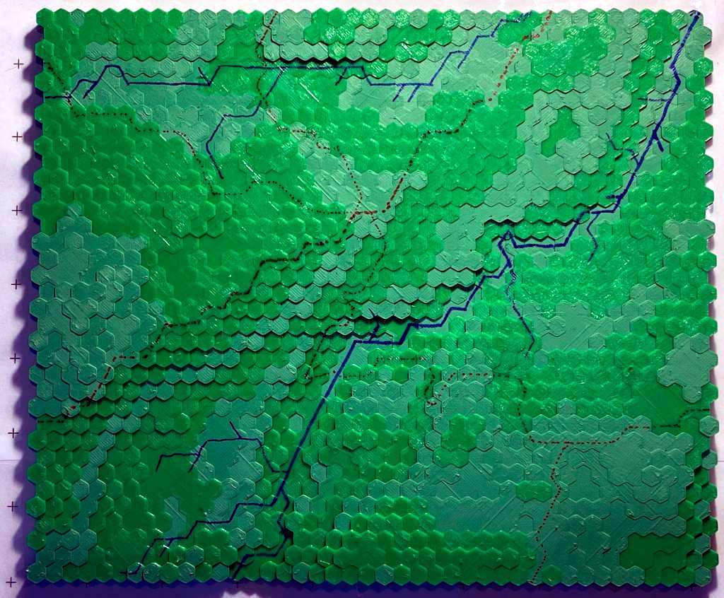
For my last campaign, the protagonists had escaped to a group of island and I told myself, those islands are not that big, I could print the relief model and share it with them, hence hex stair crawling.
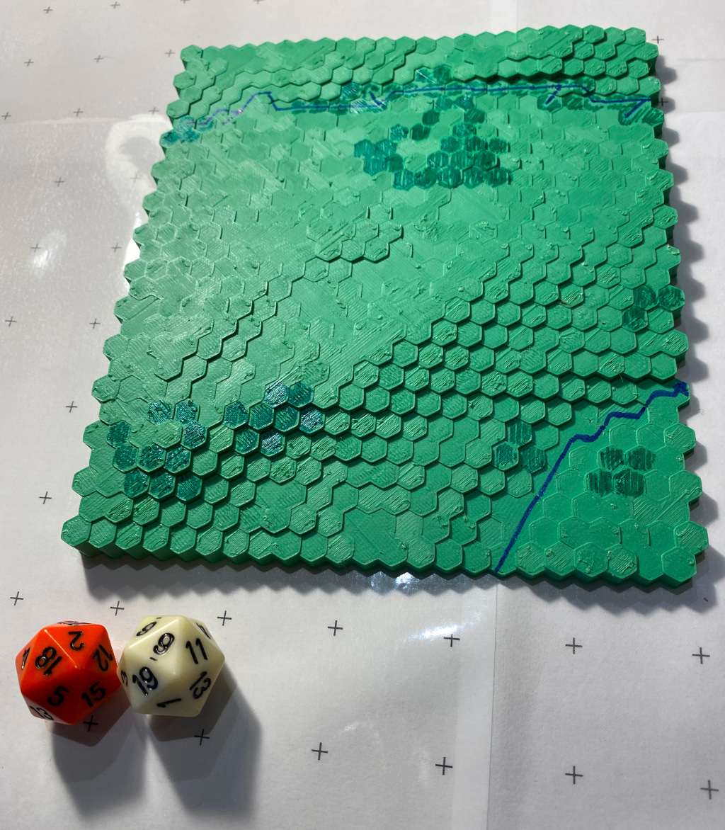
I am quite pleased with the result. I used two different greens, a bit randomly, and it helps showing the various elevation layers, for the next map, I'll probably add regular pauses to change the filament color, and all the slices will have the same "height".
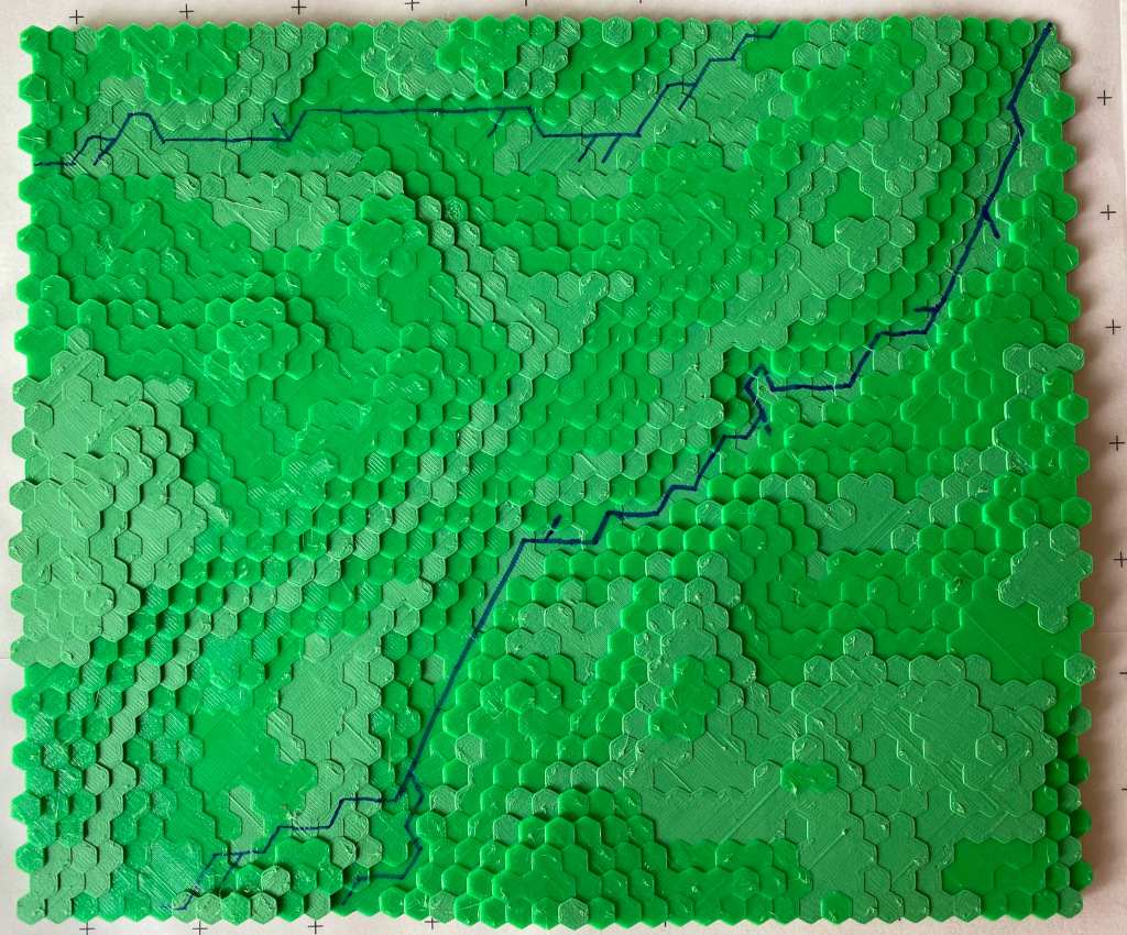
The next step is to use the webmap above and a blue sharpie to draw the two rivers. A dark green sharpie will darken the forest hexes. I will also add the roads. I did try on a prototype model and it looks ok.
I'll drop the finished map model on the table and it will be the known universe for the session. A rough explanation of what lays beyond each of the four borders will be necessary too.
update 2022-08-25
I've added rivers and roads. Guess where is the center of the village. Next step is woods. Then houses, hamlets... We'll see.


